Fifty-eight miles. Zero stoplights. One of the best paved roads in Oregon for a car, a motorcycle, or a bike — and it starts right in our backyard.
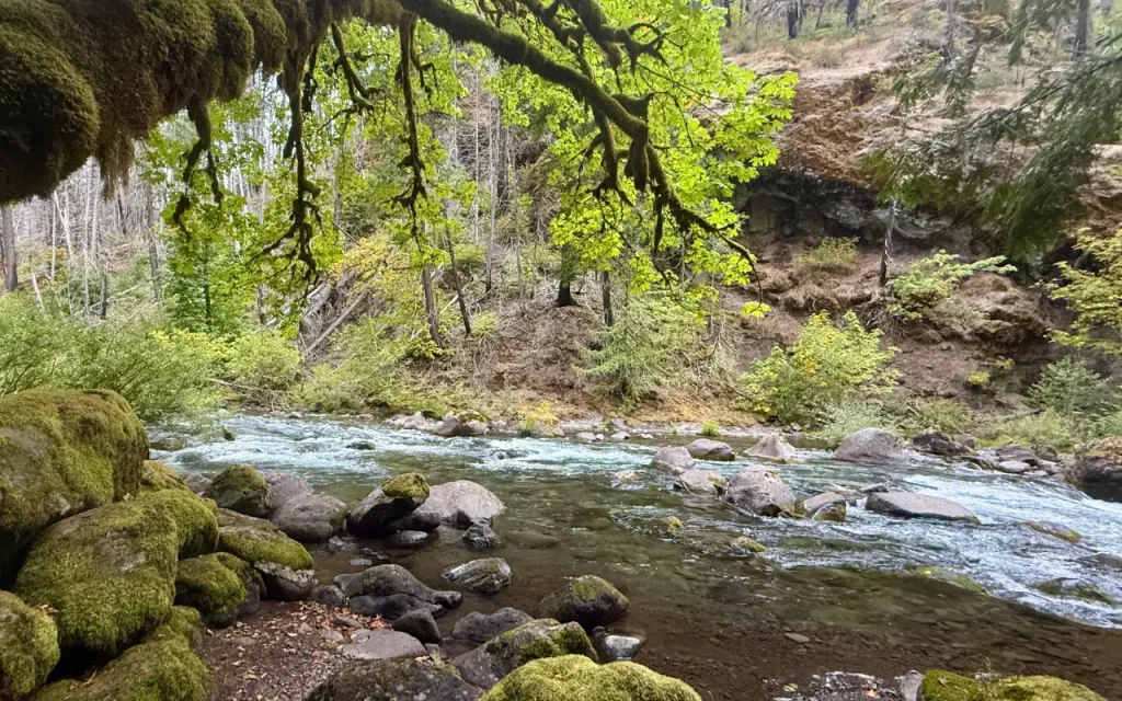
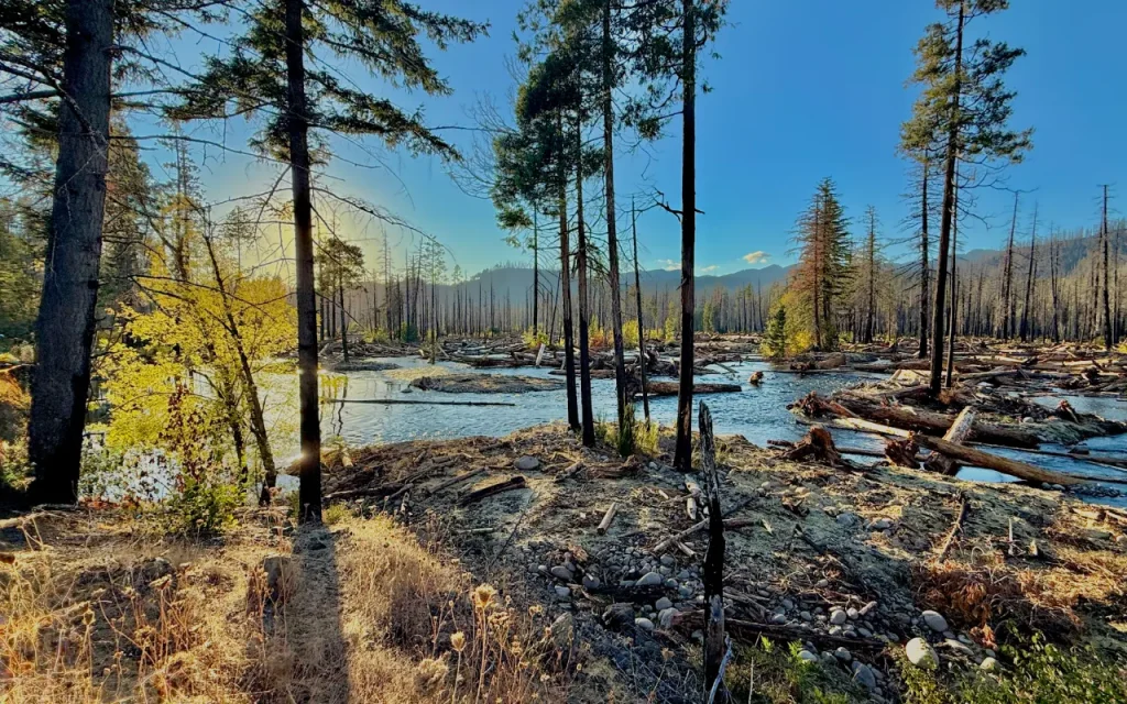
The Aufderheide Scenic Byway (officially Forest Service Road 19, and part of the larger 220-mile West Cascades National Forest Scenic Byway) runs from Highway 126 near Rainbow, just up the road from McKenzie Bridge, south through the Willamette National Forest to Highway 58 at Westfir, near Oakridge. In between, it follows the South Fork McKenzie River and then the North Fork of the Middle Fork Willamette — an officially designated Wild and Scenic River — through some of the most complete stands of old-growth Douglas fir left in the Cascades. There isn’t a gas station, a stoplight, or a mile of straight road the whole way. That’s the point.
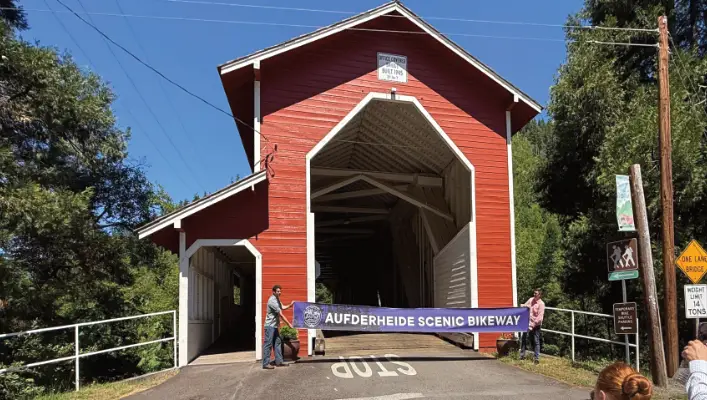
It’s officially recognized three times over: as a National Forest Scenic Byway, as a leg of the West Cascades Scenic Byway, and — as of 2024 — as Oregon’s 18th designated Scenic Bikeway, with an official ribbon-cutting in spring 2025. Locals just call it “the ‘Heide.”
Where Is the Aufderheide Scenic Byway?
- North end: Highway 126, at Rainbow, about 17 miles east of Vida and a few miles west of McKenzie Bridge
- South end: Highway 58, at Westfir, just outside Oakridge
- Length: Approximately 58 miles one-way (allow 2 hours nonstop, 4+ hours with stops)
- Route: Forest Service Road 19, through the Willamette National Forest, between the McKenzie River and Middle Fork Willamette watersheds
Most McKenzie River visitors drive it as a loop out of Eugene-Springfield: north on Highway 126 through Vida, Rainbow, and McKenzie Bridge, south on the Aufderheide through Box Canyon, then back to Eugene via Highway 58 through Oakridge — roughly 130–145 miles round trip, a full and satisfying day. Just as many visitors drive it one direction and turn around, especially if hot springs or a swim are the goal.
Why You Should Drive, Ride, or Pedal It
By car: This is the drive to take when you want to feel like you’ve left civilization without leaving pavement. Pull-outs along Cougar Reservoir make easy photo stops, the Constitution Grove and Delta Old-Growth Grove offer legs-stretching short walks under 500-year-old trees, and there’s a real chance of seeing elk, black bear, or a Northern Spotted Owl if you’re quiet and lucky. Bring a full tank — there is no fuel, and no cell service, for the entire 58 miles.
By motorcycle: Riders rate this among the best paved motorcycle roads in the Pacific Northwest. The curves are consistent-radius and well-cambered rather than tightening unpredictably, which makes for a road you can actually read and lean into — river sweepers along Cougar Reservoir, tighter technical sections through Box Canyon. Two spots deserve respect: a decreasing-radius 15–25 mph curve near the south end where a gravel side road can catch your eye at the wrong moment, and a blind, tightening hairpin around the Box Canyon area that follows a long straight. Constitution Grove, near the midpoint, is the natural rest stop — flat ground, shade, and a place to unclench before the next set of curves.
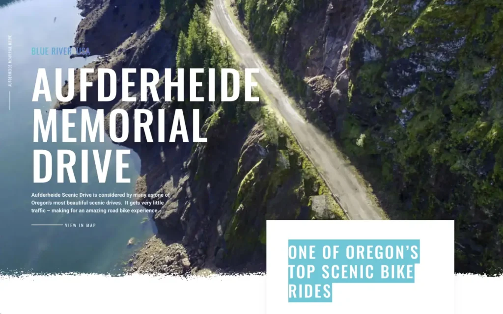
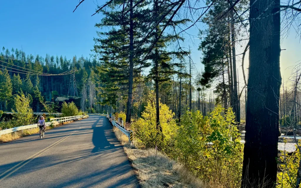
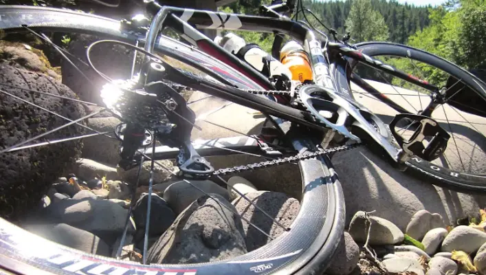
By bike: Oregon designated this the Aufderheide Scenic Bikeway in 2024 (its 18th, with a formal opening in spring 2025), and it earns the honor: about 61 miles of smooth pavement, roughly 4,000 feet of total climbing, light traffic, and long stretches where the loudest sound is the river. Travel Oregon rates it “epic” and recommends it only for riders in strong condition — there’s no bail-out point, and services are essentially nonexistent between Rainbow/Vida and Westfir/Oakridge except for trailhead water and the hot springs. More than two dozen trailheads and about a half-dozen campgrounds sit on or just off the route, so a fully loaded overnight trip is easy to plan.
“It’s by far one of the best rides I’ve ever done” Rick Dancer, talk show host: Get Real with Rick Dancer
Click image to watch Rick’s video on cycling the Aufderheide.
Points of Interest Along the Route (North to South)
- Delta Old-Growth Grove — A short, nearly level loop near the north end, close to the Highway 126 junction, through old-growth Douglas fir along the McKenzie River. A great first stop, or last stretch of the legs before heading home.
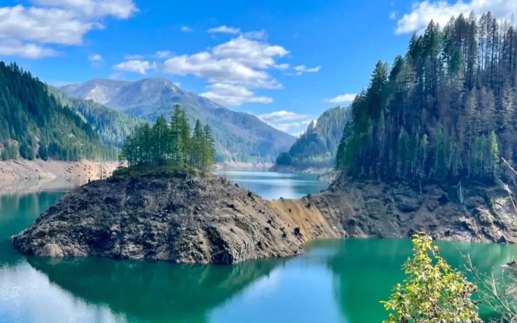
- Cougar Reservoir — Broad water views and pull-outs for photos; cliffs along the reservoir host nesting Canyon and Rock Wrens.
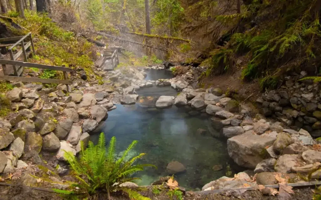
- Terwilliger (Cougar) Hot Springs — About 7–8 miles in, a quarter-mile walk from the parking area to a series of clothing-optional soaking pools terraced down a forested hillside. $12 per person cash, day use only (sunrise–10 p.m.), no pets, and parking fills fast on summer weekends — this is the single most popular stop on the byway and worth planning around.
- French Pete Trailhead — Access into the French Pete Creek drainage and the Three Sisters Wilderness, one of the last major roadless drainages added to the wilderness system after a long conservation fight in the 1970s.
- Box Canyon — The road’s most technical section for drivers and riders alike, following the North Fork Middle Fork Willamette (Wild and Scenic designated) through a narrow, forested canyon. Home to the Box Canyon Guard Station, a historic cabin available to rent through the Forest Service, and the Box Canyon Horse Camp.
- Constitution Grove — Near the midpoint (roughly mile 27 from the south end), a flat, short loop trail through old-growth fir more than 200 years old, with small plaques honoring the signers of the U.S. Constitution planted among the trees. A perfect rest stop for every kind of traveler on this route.
- Campgrounds — Frissell Crossing, French Pete, Kiahanie, Slide Creek, Homestead, Skookum Creek, and Box Canyon Horse Camp are all on or just off FS-19, most first-come, first-served and open roughly Memorial Day through late September.
When to Go
The Aufderheide is a summer-and-fall road. It is not maintained for snow or ice and typically closes from November into May or even June depending on snowpack — call ahead in shoulder season. Late June through September is the reliable window: wildflowers show up early in the season, rivers and swimming holes peak in July and August, and old-growth canopy turns the whole drive into cool, filtered shade even on a hot day. Fall brings vine maple color against the dark green conifers and noticeably lighter traffic.
Know Before You Go
| Fuel | None on the route. Fill up in Vida, Rainbow, McKenzie Bridge, Oakridge, or Westfir before you go. |
| Cell signal | Little to none for the entire 58 miles. Download maps and tell someone your plan. |
| Restrooms | Vault toilets at major trailheads and campgrounds; none in between. |
| Fees/Permits | A Northwest Forest Pass (or day fee) is required at most trailheads. Terwilliger Hot Springs charges its own separate $12/person cash fee and does not accept the Forest Pass. |
| Road conditions | Paved the entire way, but narrow in places, with no shoulder or guardrail on many curves. Watch for logging trucks, cyclists, and wildlife on the road. |
| Camping | Six-plus campgrounds along the route, mostly first-come, first-served in summer. |
| Ranger stations | McKenzie River Ranger Station, (541) 822-3381 (north end); Middle Fork Ranger Station, (541) 782-2283, 46375 Highway 58, Westfir (south end). Call either for current road and closure conditions. |
At a Glance
- Length: ~58 miles one-way (Forest Service Road 19)
- Endpoints: Highway 126 at Rainbow (north) ↔ Highway 58 at Westfir (south)
- Drive time: ~2 hours nonstop; 4+ hours recommended with stops
- Bikeway elevation gain: ~4,000 feet
- Surface: Fully paved
- Season: Reliably open late June–October; closed roughly November–May/June for snow
- Designations: National Forest Scenic Byway; segment of the West Cascades Scenic Byway; Oregon’s 18th Scenic Bikeway (designated 2024, opened spring 2025)
- Named for: Robert Aufderheide, Willamette National Forest Supervisor, 1954–1959
Frequently Asked Questions
Is the Aufderheide Scenic Byway paved the whole way? Yes. The entire 58-mile route is paved, though it’s narrow in sections with no shoulder, so drive, ride, and pedal it with full attention — especially around blind curves.
Is it a loop, or does it dead-end? It’s a one-way route from Highway 126 to Highway 58 (or vice versa), not a loop by itself. Most visitors combine it into a loop with Highway 126 and Highway 58 through Eugene-Springfield, roughly 130–145 miles round trip.
Can I drive the Aufderheide Scenic Byway in winter? Not reliably. It is not maintained for snow or ice and typically closes from November through May, sometimes later depending on the season. Call the McKenzie River or Middle Fork Ranger Station before a shoulder-season trip.
Is there gas or cell service along the route? No to both. Fill your tank before you start, in Vida, Rainbow, McKenzie Bridge, Oakridge, or Westfir, and expect no cell signal for the full 58 miles.
Is the Aufderheide good for motorcycles? It’s considered one of the best paved motorcycle roads in the Pacific Northwest, with consistent, well-built curves — but it demands real attention, particularly a decreasing-radius curve near the south end and a blind hairpin near Box Canyon. Ride within your limits and watch for gravel, logging trucks, and wildlife.
Is the Aufderheide Scenic Bikeway hard? Yes — Travel Oregon rates the full 61-mile bikeway as extreme, with about 4,000 feet of climbing and no services along most of the route. It’s a serious ride for a fit, experienced cyclist, not a casual family outing, though shorter out-and-back sections (for example, to Terwilliger Hot Springs or Constitution Grove) work well for less experienced riders.
What’s the best time of year to drive the Aufderheide? Late June through September, when the route is reliably free of snow, swimming holes and the hot springs are at their best, and days are long enough for the full loop with stops. Fall (late September–October) offers great color and lighter traffic.
Do I need a permit or pass? Most trailheads along the route require a Northwest Forest Pass or a day-use fee. Terwilliger (Cougar) Hot Springs charges its own separate cash-only fee and does not accept the Forest Pass.
Are dogs allowed? Pets are welcome at most trailheads and campgrounds along the route but are not permitted at Terwilliger Hot Springs (service animals excepted).
Where should I stop if I only have time for one or two things? Terwilliger Hot Springs and Constitution Grove are the two most rewarding stops for a first-timer with limited time — one soaking, one walking, both easy to reach from the road.
Nearby on VisitMcKenzieRiver.com
- Terwilliger (Cougar) Hot Springs
- Cougar Reservoir
- French Pete Trail
- Constitution Grove Trail
- Delta Old-Growth Trail
- McKenzie Bridge
- Oakridge & Westfir

1 Review on “The Aufderheide Scenic Byway”
This is a beautiful ride, by car, motorcycle or bike! Every who has done the has been surprised by how few vehicles are on this road. Tip – go slow and stop often.