
Hiking trails · Waterfalls · Highway 126 near Clear Lake
Waterfalls Loop: Sahalie & Koosah Falls
USFS Trail #3503
Two thundering waterfalls on one short, unforgettable loop along the young McKenzie River, with mist, rainbows and old growth the whole way.
★Highlights around the loop
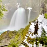
 mi 0Sahalie FallsAbout 100 feet of roaring whitewater, with an accessible viewpoint.
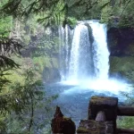
 ~mi 0.5Koosah FallsA 64-foot plunge into a big blue pool. Look for rainbows.
 Along the wayOld growth and wild treesBig conifers, mossy logs and one gloriously twisted trunk.
 ~mi 0.8–2The quiet west bankCross a footbridge and return on the McKenzie River Trail.
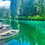
 NearbyClear Lake LoopEasy 5-mile loop around the McKenzie’s glass-clear source.
 Down the riverTamolitch Blue PoolThe McKenzie reappears from underground in unreal blue.
Mileages are approximate, counterclockwise from Sahalie Falls.
Trail map and elevation
Route from OpenStreetMap; elevations from the USGS 3D Elevation Program. The chart starts at Sahalie Falls and goes counterclockwise: down the east bank on the Waterfalls Trail (#3503) past Koosah Falls, across the river near Carmen Reservoir, and back up the west bank on the McKenzie River Trail (#3507).
━ Waterfalls Loop ● Waterfall viewpoints ● Footbridges ■ Sahalie Falls parking
Directions to the Sahalie Falls parking area · Trail on OpenStreetMap
Everything above is the quick answer. Scroll on for the details, the backstory and tips.
The loop, step by step (counterclockwise from Sahalie Falls)
Sahalie Falls (mile 0). From the parking area, a short paved path leads to the accessible Sahalie Falls viewpoint, where the river pours roughly 100 feet over an old lava ledge and fills the canyon with cool mist.
Down the east bank to Koosah Falls (0–0.5 mi). Follow the Waterfalls Trail downstream. Between the two falls, the river stair-steps through a series of unnamed but very impressive cascades. At about half a mile you reach the Koosah Falls viewpoints, where the river drops 64 feet into a big pool. On sunny mornings, look for rainbows in the spray.
Across the river (about 0.8 mi). Continue past Koosah to the footbridge near Carmen Reservoir and cross to the west bank. This is the low point of the loop.
Up the west bank (0.8–2 mi). Turn upstream on the McKenzie River Trail. This side is quieter, with views back across the river to both waterfalls from the other side. It's also a shared-use trail, so watch for mountain bikers. Cross the upper footbridge above Sahalie Falls at about 2 miles.
Back to Sahalie (about 2.5 mi). A short walk downstream returns you to the Sahalie Falls viewpoint and parking.
What the names mean
Both falls carry names in Chinook Jargon, the old trade language of the Pacific Northwest: Sahalie means "heaven" and Koosah means "sky." Fitting for two waterfalls this blue.
Fees, facilities, accessibility and winter
Fees: none. The Sahalie and Koosah Falls day use sites are free and open 6am to 10pm.
Facilities: vault toilets, picnic tables and viewing platforms at the falls; no drinking water, so bring your own. Potable water is available at nearby Ice Cap Campground.
Accessibility: the main Sahalie Falls viewpoint is ADA accessible. The full loop is not: expect stairs, roots and a few narrow spots where you'll want to hold little hands. Not stroller friendly.
Bikes: cyclists must dismount and walk on the east side of the loop between the Koosah and Sahalie viewpoints.
Winter: Highway 126 stays open, but the trail isn't marked under snow and route-finding can be hard. Snowshoes or skis are recommended. The Forest Service doesn't maintain the lots for winter; a small pullout is typically plowed at the Sahalie viewpoint, but conditions vary. Don't park on the highway.
Getting there
From McKenzie Bridge, drive east on Highway 126 toward Clear Lake. For Koosah Falls, turn left at the Ice Cap Campground / Koosah Falls sign just north of the Carmen Reservoir turnoff. For Sahalie Falls, continue about half a mile farther north; the parking area is on the left.
Ways to enjoy it
A 2.5-mile day loop. Motorized vehicles and stock are prohibited, and don't park on the highway shoulder.
Day hiking on Waterfalls Loop: Sahalie & Koosah Falls: Allowed
About 2.5 miles with stairs, roots and two footbridges. Short legs can do it, but strollers can't. If you only want the view, the Sahalie Falls viewpoint is a few steps from the parking lot.
In winter the trail isn't marked under snow, so bring snowshoes and good route sense.
Backpacking on Waterfalls Loop: Sahalie & Koosah Falls: Not a good fit
It's a short day loop, so there's nowhere to go overnight. For a multi-day trip, keep walking: the loop's west side is the McKenzie River Trail, which runs 26 miles to the lower trailhead.
Mountain biking on Waterfalls Loop: Sahalie & Koosah Falls: West side only
Bicyclists must dismount and walk bikes on the east side of the loop between the Koosah and Sahalie viewpoints. The west side is the McKenzie River Trail, which is open to bikes, so riders usually see the falls from there.
Trail running on Waterfalls Loop: Sahalie & Koosah Falls: Allowed
A quick, rooty loop that pairs well with a longer MRT run. The east side gets crowded midday, so it runs best early or late.
Horseback riding on Waterfalls Loop: Sahalie & Koosah Falls: Not allowed
Stock is prohibited on this trail.
Want to ride? Box Canyon Horse Camp on the Aufderheide is a free, primitive stock camp with corrals and hitching posts, built for horse trips.
Motorcycle / ATV on Waterfalls Loop: Sahalie & Koosah Falls: Not allowed
Motorized vehicles are prohibited.
Motorized riders: stick to the roads and routes shown as open on the Willamette National Forest Motor Vehicle Use Map (free at the ranger station).
Allowed Allowed with limits Not allowed Not a good fit
Sahalie means “heaven” and Koosah means “sky.” One look and you’ll see why.
⌂What’s nearby
Distances are straight-line miles from the closest point on the loop. See them all on the Explore map.
Nearby lodging
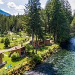
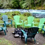
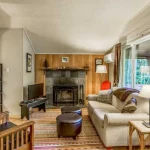
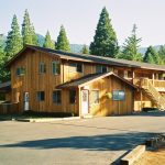
Nearby food and drink
Nearby attractions
Nearby campgrounds
Nearby gas

Frequently asked questions
How long is the Waterfalls Loop?
About 2.5 miles around (guides list 2.4 to 2.6 miles), with roughly 350 feet of ups and downs. It combines the Waterfalls Trail (Forest Service Trail #3503) on the east bank with the McKenzie River Trail on the west bank.
Can I just see the waterfalls without hiking?
Yes. Sahalie Falls has an accessible viewpoint a short walk from the parking area, and Koosah Falls has its own parking area and viewpoints.
Is there a fee?
No. The Sahalie and Koosah Falls day use sites are free and open 6am to 10pm.
Is it good for kids?
Yes, it's short and spectacular. There are stairs and a few narrow spots near steep drop-offs, so hold little hands and skip the stroller.
Can I bike it?
The west side is part of the McKenzie River Trail and open to mountain bikes. Cyclists must walk their bikes on the east side between the Koosah and Sahalie viewpoints.
Can I go in winter?
Yes, with care. Highway 126 stays open, but the trail is unmarked under snow; snowshoes or skis are recommended. A small pullout is usually plowed at the Sahalie viewpoint.
Sources: USFS Waterfalls Loop Trail #3503 · Oregon Discovery: Waterfalls Loop · Go Wander Wild: Sahalie and Koosah Falls · Outgrown: Sahalie & Koosah Falls Loop. Checked November 2026.