Visit McKenzie River

Explore the McKenzie River

Explore all the popular places in the McKenzie River area.

Find the best of the McKenzie River: waterfalls and hot springs, trails, boat launches, campgrounds, and the local places to eat, stay and shop along the way.

Don’t-miss places along the McKenzie River

lakes
Author Image

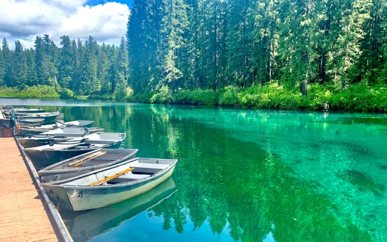
Clear Lake

Attractions
Author Image

Terwilliger Hot Springs

New Hiking
Author Image

Clear Lake Loop

Hotels and resorts for you.
Lodging
Author Image

Inn at the 5th

Resort
Author Image

Loloma Lodge

Resort
Author Image

Vida View Resort

How Visit McKenzie River works

Visitor:

The McKenzie River is a magical place, the variety of natural wonders in the surrounding Willamette National Forest is awe inspiring. 

The communities here are small and Oregon has gone out of its way to limit growth and development here to protect the surrounding beauty.

This directory is designed to help you find these hidden gems as well as the local businesses that support the care and maintenance  of the surrounding forest.

When visiting, please be sure to stop for a good meal, buy some fuel, supplies and keepsakes, and if you can stay the night in one of our many beautiful lodges and vacation homes.  

Business Owner:

Our directory is managed by McKenzie Community Partnership to help strengthen our communities economy.

If you have a business or attraction you want included on our list, reach out to us.  We are a non-profit and work with the McKenzie River Chamber of Commerce. 


Are You Special?

Let's share that with the world!

Select location

Where are you located?

Select category

Place you in the appropriate category.

View results

Connect with clients looking for what you offer.

Join us now!

Join us and reap the benefits of our McKenzie River directory!

We have 2 directories created on one platform: 

Tourism:  Connecting visitors to our attractions and businesses

Community: Our “60 mile Main Street” is designed to help connect residents with local services.  

Our travel writers and editors create unique value by helping to highlight what’s great or amazing about an attraction or local business.

Our standard listings help people find the other good stuff they need to make their experience enjoyable.

Optionally, we provide more in depth write-ups, photos, video to help people find the right solutions and destinations for the best fit for  their needs.

Easy registration

Easy to get started

Promote your listing

Put your images and your message out there.

Get on the map

Help people find the best stuff in your community.

Great sales benefits

Good content drives traffic and sales. It even boosts your Google search rankings!

Smiling man in an orange t-shirt
we are always growing and adding new content.

About the McKenzie River

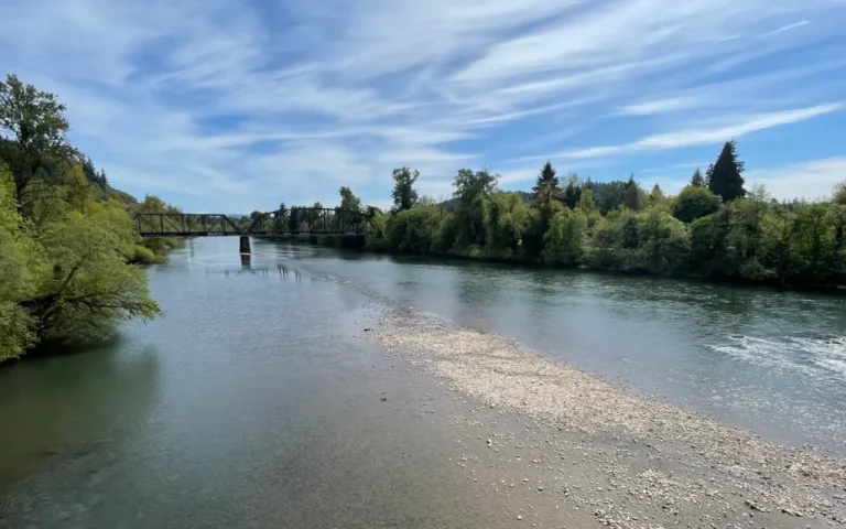
The McKenzie River begins at Clear Lake, high in the Oregon Cascades in the Willamette National Forest. It flows south over Sahalie and Koosah Falls, then turns west past McKenzie Bridge, Blue River, Vida, Leaburg and Walterville, runs along the north side of Springfield, and joins the Willamette River about 5 miles north of Eugene. Oregon Route 126, the McKenzie Highway, follows the river most of the way.

Much of the upper river is a federally designated Wild and Scenic River, known for cold, clear water, drift-boat fishing, the McKenzie River Trail, hot springs and old-growth forest. Visit McKenzie River is a free guide from McKenzie Community Partnership, a nonprofit working with the McKenzie River Chamber of Commerce to support the communities along the river.

Frequently asked questions +

Where does the McKenzie River start and end? It starts at Clear Lake in the Cascades and flows south, then west, to join the Willamette River about 5 miles north of Eugene. Along the way it passes Sahalie and Koosah Falls, McKenzie Bridge, Blue River, Vida, Leaburg, Walterville and Springfield.

How far is the McKenzie River from Eugene? The lower river runs along the north edge of Springfield, minutes from Eugene. McKenzie Bridge, the gateway to the upper river, is about an hour east on Oregon Route 126, and the Sahalie and Koosah Falls loop is farther up the same highway.

Do I need a pass to park at boat launches and trailheads? It depends on who manages the site. Many Lane County landings require a Lane County parks day or annual pass, Willamette National Forest sites generally use a Northwest Forest Pass or a posted day-use fee, and some landings are free. Each boat landing and campground page lists its pass rules; fees change, so check the posted signs.

What is the McKenzie River Trail? A trail of about 26 miles along the upper river, from near Clear Lake down toward McKenzie Bridge. It passes Sahalie and Koosah Falls and Tamolitch Blue Pool. See the McKenzie River Trail guide.

How do I check river conditions before floating or fishing? Every boat landing page on this site shows a live USGS flow reading, with links to American Whitewater trip reports and the Oregon State Marine Board obstruction map. The water is cold year-round, so wear a life jacket.

Is McKenzie Pass (Highway 242) open all year? No. The scenic highway over McKenzie Pass closes to cars in winter. Highway 126 over Santiam Pass stays open; check ODOT TripCheck for current conditions.