By Chris LaVoie
If you love the sound of tires on a winding forest road, the smell of damp fir needles, and a river flashing blue-green beneath a canopy of gold, now is the time to plan a fall trip along the McKenzie River.
Peak color typically arrives around the second week of October, with higher elevations changing first and the lower river corridor following a little later. For 2026, current forecasts point toward especially strong color around October 19–22 in many parts of the region. Weather can shift the schedule by several days, but late September is an excellent time to start planning.
Here are three scenic drives to put on your autumn itinerary, plus a full-day loop that strings several of them together.
A quick guide to fall color timing
- Late September: Early color begins at higher elevations, especially along Highway 242 and the upper portions of Forest Service Road 19.
- Early to mid-October: Vine maple and huckleberry shrubs brighten the mountain roads.
- Second week of October: Often the best overall window for the McKenzie River region.
- October 19–22, 2026: A promising peak period for the river corridor and mid-elevation forests.
- Late October: Lower elevations around Leaburg, Walterville, Vida, and the lower McKenzie often hold color after the high country has faded.
The signature palette here is big-leaf maple gold, vine maple orange and red, red alder yellow, and deep evergreen Douglas fir. Against the McKenzie’s exceptionally clear water, the colors look even brighter.
1. McKenzie River Scenic Byway: Highway 126

For the easiest introduction to McKenzie River fall color, start with Highway 126. This is the main artery from Springfield and Eugene through Walterville, Leaburg, Vida, Blue River, Rainbow, and McKenzie Bridge.
It is the most accessible of the three drives, with regular communities, fuel, food, and lodging along the way. The elevation is lower than the mountain byways, so the best color often arrives a little later, but the season can last well into late October.
What you’ll see
Near Leaburg Lake, look for colorful trees reflected in the calmer water. Around Vida, take a detour to the historic Goodpasture Bridge, one of Oregon’s classic covered bridges. You can also pair it with the nearby Belknap Bridge for a covered-bridge photo outing.
Farther east, the river grows wilder and the forest deepens. The short walks to Sahalie and Koosah Falls are especially beautiful in autumn, when gold leaves frame the rushing white water. The two waterfalls are close together and can be combined into a longer loop hike if trail conditions are good.
At the upper end of the route, turn toward Clear Lake, the spring-fed source of the McKenzie River. The lake’s glassy water, submerged trees, and surrounding forest make it one of the most atmospheric stops of the season. Clear Lake is also an access point for the upper McKenzie River Trail.
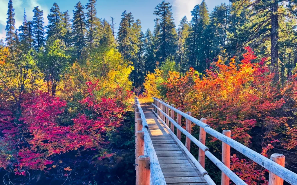
McKenzie River Trail – upper trailhead just above Clear Lake.
Best timing and practical notes
Plan this drive for mid-October through late October if your priority is color along the river. Give yourself more time than the driving distance suggests. This is a route made for frequent stops, coffee breaks, covered bridges, waterfall viewpoints, and short walks.
For a wider overview of the area, explore the McKenzie River region guide before you go. Stock up on fuel, snacks, and rain gear in the communities along the route, and consider making a local café, restaurant, lodge, or farmstand part of your itinerary.
2. Aufderheide Scenic Byway: Forest Service Road 19
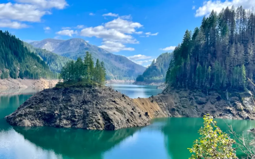
Locally known as “the ‘Heide,” the Aufderheide Scenic Byway runs about 58 miles from Highway 126 near Rainbow south to Highway 58 at Westfir.
This is the quiet, wild-feeling option: no stoplights, no fuel stations, very little cell service, and long stretches where the forest completely takes over. In fall, vine maple glows against dark conifers and traffic is noticeably lighter than in summer.
What you’ll see
Starting near Highway 126, consider stopping at Delta Old-Growth Grove before following the South Fork McKenzie River toward Cougar Reservoir. Pull-outs along the reservoir offer broad water views surrounded by forested slopes.
The road also provides access to Terwilliger (Cougar) Hot Springs, where autumn soaking means warm water, cool air, and steam drifting into the trees. The site charges a $12 cash day-use fee, and no pets are allowed at the hot springs; bona fide service animals must remain leashed and under control.
Other fall stops include the French Pete Trailhead, Box Canyon, and Constitution Grove, where a short walk beneath old-growth trees makes a welcome break from the road.
Best timing and practical notes
The higher portions of the route can begin changing in late September, with strong color generally arriving in early to mid-October. Lower stretches near the rivers may stay colorful into the second half of the month.
Fill your tank before starting. There is no fuel and little to no cell service along the byway, so download offline maps and tell someone where you’re going. The road is paved but narrow and curvy, with wildlife, cyclists, logging vehicles, and wet leaves to watch for.
The Aufderheide is a summer-and-fall road. It is not maintained for snow and ice and typically closes sometime from November into May or June, depending on conditions. Check with the Forest Service before a late-season trip.
3. McKenzie Pass–Santiam Pass Scenic Byway: Highway 242

Highway 242-the Old McKenzie Highway, is the high-country choice. It climbs from the McKenzie River side toward the Cascade crest, where vine maple, huckleberry, and other shrubs turn before the lower forests.
The road is seasonal and usually open from roughly June through early November, depending on snow. The car-free cycling window happens earlier in the season, so by fall this is primarily a scenic drive.
What you’ll see
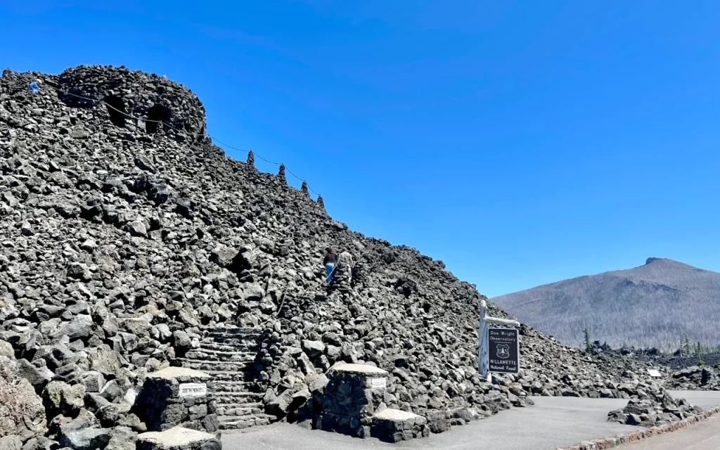
The higher elevation creates a dramatic contrast: red and orange shrubs beside black lava fields, green firs, and wide views across volcanic terrain. The highlight is Dee Wright Observatory, a stone viewpoint built from local lava rock with sweeping views of the Cascade peaks and surrounding lava flows.
Highway 242 is also a useful access route for exploring the upper McKenzie area, including the turnoff toward Clear Lake and the waterfall corridor.
Best timing and practical notes
Because elevation drives the color schedule, aim for late September through the first half of October for the brightest high-country display. By October 19–22, the lower sections may be excellent even if some of the highest shrubs are past peak.
Check the ODOT McKenzie Highway page and TripCheck before driving. Snow, ice, debris, storms, or early seasonal closures can change access quickly. Vehicles longer than 35 feet are not allowed on portions of the route, and trailers are strongly discouraged because of the narrow road and sharp curves.
Suggested fall color loop: a full day on the road
For a memorable autumn road trip, create a loop by traveling east on Highway 126 through the McKenzie corridor, turning south onto the Aufderheide Scenic Byway, continuing to Highway 58 near Westfir, and returning toward Eugene-Springfield through Oakridge.
The loop is roughly 130–145 miles, depending on your starting point and detours. With stops, short walks, meals, photographs, and changing road conditions, plan on a full day.
Start early. Daylight is shorter in October, and you’ll want time for:
- Coffee, fuel, and breakfast in one of the small communities along the route
- Goodpasture or Belknap Bridge
- Sahalie and Koosah Falls
- A reservoir pull-out on the Aufderheide
- Constitution Grove or another short forest walk
- A meal in Oakridge, Vida, Blue River, or another local community
Choosing local restaurants, cafés, fuel stations, lodging, and shops helps keep the region’s 60-mile Main Street thriving while supporting the people who care for these forests and communities.
What to bring for an autumn drive
Pack more than a camera, even if photography is your main goal:
- Warm layers and waterproof outerwear
- Sturdy shoes with good traction
- Rain gear
- Water, snacks, and emergency supplies
- A full tank of gas
- Offline maps
- A Northwest Forest Pass or required trailhead day-use pass
- A Discover Pass only if your wider trip includes Washington lands
- A headlamp for late returns
- Binoculars for wildlife and river views
Watch for frosty mornings, wet leaves, falling branches, wildlife near the road, and rapidly changing mountain weather.
If you plan to visit waterfalls after snow arrives, remember that winter waterfall hikes should only be attempted by experienced snow hikers with proper equipment. Snow can hide trail junctions, ice can make overlooks dangerous, and conditions may be very different from what you see beside the highway.
Frequently asked questions
When is the best time to see fall colors on the McKenzie River?
The best overall window is usually the second week of October. For 2026, forecasts suggest that October 19–22 may bring peak or near-peak color along much of the river corridor, while higher elevations may peak slightly earlier.
Which scenic drive is easiest?
Highway 126 is the easiest and most accessible. It has the most services, lower elevations, and many attractions close to the road.
Which route has the least traffic?
The Aufderheide Scenic Byway generally has lighter traffic, especially in fall. It also has no fuel stations and little to no cell service, so prepare carefully.
Is Highway 242 open in October?
It is often open in October, but the road can close early because of snow, ice, storms, debris, or other conditions. Always check ODOT and TripCheck shortly before your trip.
Can I see waterfalls and fall colors on the same drive?
Absolutely. Highway 126 connects the river corridor with Sahalie Falls, Koosah Falls, Clear Lake, covered bridges, and numerous short trails and viewpoints.
Are dogs allowed on these routes?
Dogs are allowed in many outdoor areas when leashed and under control, but individual trailheads and attractions may have different rules. Pets are not allowed at Terwilliger Hot Springs; bona fide service animals are permitted under the site’s rules.
Should I reserve lodging in advance?
Yes, especially for weekends around mid-October. Staying in the McKenzie River communities lets you start early, enjoy a slower drive, and support local lodging businesses.
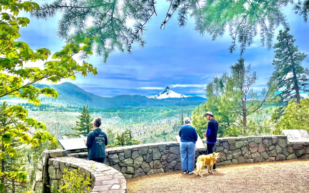
Mount Washington, Hwy 20, between McKenzie River and Bend Oregon.
Photos by Chris LaVoie
